Location & Maps
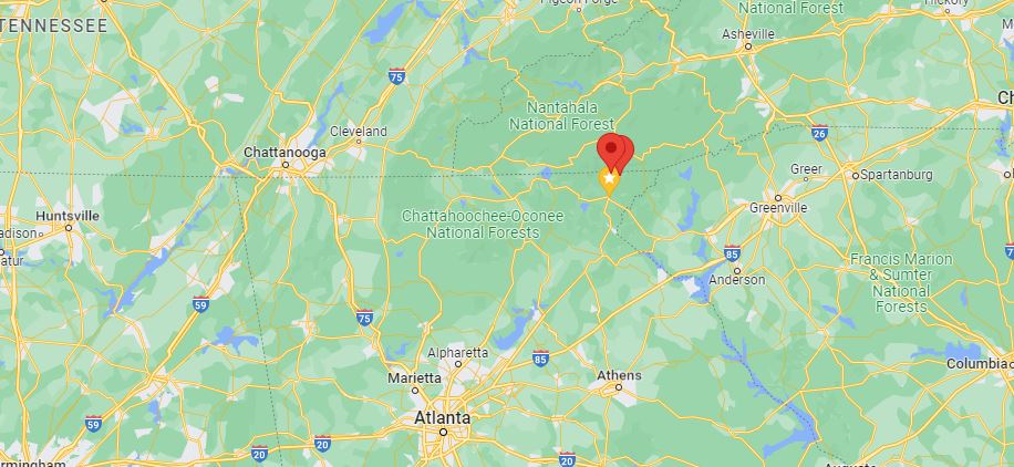
Sky Valley is nestled in the northeast Georgia mountains on the slopes of Rabun Bald, Georgia’s second-highest peak, and bordered by the Chattooga River district of the Chattahoochee National Forest. We are approximately two hours from Atlanta, GA, Asheville, NC, and Greenville, SC; and approximately 30 minutes from Dillard and Clayton, GA, and Highlands and Franklin, NC.
Get Directions …

From Atlanta
Take I-85 North to Exit 113 (I-985 toward Gainesville, GA)
Go approximately 80 miles on I-985 / US-23 / US-441 North
Turn right on GA 246 at the traffic light in Dillard
Go 4 miles; follow signs to Sky Valley Resort
Turn right on Old Mud Creek Road at the blinking yellow light
Go 1 mile
Turn right at the flagpole with stone sign: “Sky Valley Country Club and Resort”
From Asheville
Take I-40 West to Exit 27 (US-74/US-19/US-23 toward Clyde/Waynesville)
Go approximately 26 miles on US-74 West (Great Smoky Mountains Expressway)
Take Exit 81 (US-23 South/US-441 South toward Dillsboro/Franklin/Atlanta)
Go approximately 20 miles to Franklin, NC
Take right lane to US-23 South/US-441 South toward Clayton/Atlanta
Go approximately 13 miles
Turn left on GA 246 at the traffic light in Dillard
Go 4 miles; follow signs to Sky Valley Resort
Turn right on Old Mud Creek Road at the blinking yellow light
Go 1 mile
Turn right at the flagpole with stone sign: “Sky Valley Country Club and Resort”
From Greenville
Take I-85 South to Exit 11 (SC-24 West toward Townville)
Turn right on SC-24
Go approximately 18 miles
Turn left on US-123/Main Street in Westminster
Go approximately 1 mile
Turn right on US-76 West toward Long Creek/Clayton
Go approximately 25 miles
Turn right on US-23/US-441 North in Clayton
Go approximately 8 miles
Turn right onto GA 246 at the traffic light in Dillard
Go 4 miles; follow signs to Sky Valley Resort
Turn right on Old Mud Creek Road at the blinking yellow light
Go 1 mile
Turn right at the flagpole with stone sign: “Sky Valley Country Club and Resort”
North Georgia & Rabun County


